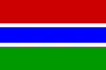
Gambia
Man Convicted For Possession Of Duplicated Keys
Complainant Testified In Assault case
Police Officer Testifies In Burglar Case
An Ex-Convict In Trouble Again
The President Has Said It All
Training Of Youths On Business Enterprise Development Underway
Official Name: Republic of the Gambia
Geography
Capital: Banjul
Major Towns: Serrekunda, Bakau, Brikama, Basse
Location (geographical coordinates/latitude and longitude): 13°28'N, 16°36'W
Time Zone: GMT
Size (Land and Sea): 11,300 sq km
Borders with Senegal 740 km
Elevation extremes: Lowest point: Atlantic Ocean 0 m; Highest point: unnamed location 53 m
Politics
Head of State: President Yahya A.J.J. Jammeh
Form of Government: Republic
Independancy (from UK): February 18, 1965
Currency: Dalasi (GMD)
Industry
Main industries: Processing peanuts, fish, and hides; tourism, beverages, agricultural machinery assembly, woodworking, metalworking, clothing
Natural resources: fish, titanium (rutile and ilmenite), tin, zircon, silica sand, clay, petroleum
Agriculture: rice, millet, sorghum, peanuts, corn, sesame, cassava (tapioca), palm kernels; cattle, sheep, goats
Population and People
Population: 1,688,359 (July 2007 est.)
Population density per sq mi: 437
Growth rate: 2.8%
Birth rate: 38.86 births/1,000 population (2007 est.)
Total fertility rate: 5.21 children born/woman (2007 est.)
Infant mortality rate: 70.1/1000
Religion: Muslim 90%, Christian 9%, indigenous beliefs 1%
Languages: English (official), Mandinka, Wolof, Fula, other indigenous vernaculars
Ethnic groups / Tribes: Mandinka 42%, Fula 18%, Wolof 16%, Jola 10%, Serahuli 9%, other 4%, non-African 1%
Average age: 0-14 years: 44.1% (male 373,831/female 370,397); 15-64 years: 53.2% (male 445,365/female 452,311); 65 years and over: 2.8% (male 23,582/female 22,873) (2007 est.)
Life expectancy: 54.5
Literacy (definition: age 15 and over can read and write): Total population: 40.1%; male: 47.8%; female: 32.8% (2003 est.)
- The smallest country on the African continental mainland: less than 48 km wide
- Colourful buzz of weekly markets upcountry
- Mangrove creeks
- Bordered entirely by Senegal (and the Atlantic Ocean)
- Was part of the ancient Mali Empire
- More than 63% of Gambians live in rural villages (1993)
- Popular tourist destination: The number of visitors increased from 300 tourists in 1965 to 25,000 visitors in 1976
- In 1816, the British founded Banjul (the capital) as a trading post and base for suppressing the slave trade
- Banjul with Gambian National Museum, the Albert Market, Banjul State House, Banjul Court House, two cathedrals and several major mosques.
- Gambia is the fourth most densely populated country in Africa
- In his 1977 Pulitzer Prize-winning book Roots: The Saga of an American Family, Alex Haley traced his family back to Kunta Kinte, enslaved from the village of Juffure on the north bank of The Gambia.
- Sacred crocodile pools used as sites for fertility rituals
- The Gambia was the first and last British colony in West Africa
- En route to Casablanca for a conference and then to Liberia, U. S. President Franklin D. Roosevelt became the first serving U. S. president to visit the African continent when he stopped in Banjul in 1943
- In the 1930s, The Gambia was a transit point for the German airline Lufthansa's transatlantic mail service. Three aircraft were lost during this period
- Yundum Airport was an emergency landing site for NASA space shuttles
- Sandy beaches
- Tropical forests
- Birdwatcher's paradise, with over 540 different species
- Pleasant tropical climate and relaxing beach resorts
- Kora (The Gambia's national instrument)
- Famous Roots Festival is a highly publicised annual celebration aimed at getting Americans and Europeans of African descent back in touch with Africa
 Text Area - Gambia
 Content List - Gambia News
 Map - Gambia Map