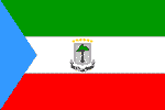
Equatorial Guinea
EQUATORIAL GUINEA: Poverty rife in Africa’s “Kuwait”
EQUATORIAL GUINEA: Oil money draws sub-Saharan Africans
EQUATORIAL GUINEA: Oil money draws sub-Saharan Africans
Guinea coup trial defendant names co-conspirators
Gambia Absent in 2008 African Women Championship
National name: Républica de Guinea Ecuatorial
Geography
Capital: Malabo
Major Towns: Luba, Bata, Mbini, Mongomo
Location (geographical coordinates/latitude and longitude): 3°21'N, 8°40'E
Time Zone: WAT (UTC+1)
Size (Land and Sea): 28,051 sq km
Borders with Cameroon 189 km, Gabon 350 km
Elevation extremes: Lowest point: Atlantic Ocean 0 m; Highest point: Pico Basile 3,008 m
Politics
Head of State: President: Col. Teodoro Obiang Nguema Mbasogo (1979), Prime Minister: Ricardo Mangue Obama Nfubea (2006)
Form of Government: Republic
Independancy (from Spain): October 12, 1968
Currency: CFA franc (XAF)
Industry
Agriculture: coffee, cocoa, rice, yams, cassava (tapioca), bananas, palm oil nuts; livestock; timber
Industries: petroleum, fishing, sawmilling, natural gas.
Natural resources: petroleum, natural gas, timber, gold, bauxite, diamonds, tantalum, sand and gravel, clay.
Population and People
Population: 551,201 (July 2007 est.)
Population density per sq mi: 51
Growth rate: 2.0%
Birth rate: 35.16 births/1,000 population (2007 est.)
Total fertility rate: 4.48 children born/woman (2007 est.)
Infant mortality rate: 87.2/1000
Religion: nominally Christian and predominantly Roman Catholic, pagan practices
Languages: Spanish 67.6% (official), other 32.4% (includes French (official), Fang, Bubi) (1994 census)
Ethnic groups / Tribes: Fang 85.7%, Bubi 6.5%, Mdowe 3.6%, Annobon 1.6%, Bujeba 1.1%, other 1.4% (1994 census)
Age structure: 0-14 years: 41.5% (male 114,816/female 113,688); 15-64 years: 54.8% (male 145,740/female 156,097); 65 years and over: 3.8% (male 8,957/female 11,903) (2007 est.)
Life expectancy: 49.5
Literacy (definition: age 15 and over can read and write): Total population: 85.7%; male: 93.3%; female: 78.4% (2003 est.)
- One of the smallest countries in continental Africa
- It is the only country in mainland Africa where Spanish is an official language
- Equatorial Guinea is the smallest country, in terms of population, in continental Africa
- The smallest United Nations member from continental Africa
- Pygmies and Bantu history
- It had the highest per capita income of Africa in 1959
- Large oil reserves
- The third-largest oil producer in Sub-Saharan Africa
- Forestry, farming, and fishing are also major components of GDP
- Per capita GDP (PPP) of more than US$30,000 which is as of 2006 the second highest in the world (after Luxembourg)
- Cocoa and coffee plantations
- Coastline: 296 km
- Volcanic islands
- Luscious vegetation
- Tropical forests
- Spanish colonial architecture
- White-sand beaches
- The country was first of all named 'Formosa', meaning 'beautiful', by the Portuguese
- Pico Malabo volcano
- Mountain climbing
- Frederick Forsyth wrote his novel The Dogs of War in Malabo, the capital
- Moca valley in the southern highlands, also a spiritual centre for the Bubi people
- Cascades of Moca
- Several species of monkey
- During the dry season, turtles come ashore to lay their eggs
- Monte Alen National Park
 Text Area - Text Area
 Content List - Equatorial Guinea News

 Map - Equatorial Guinea Map