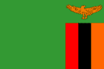
Zambia
Low copper prices to hit Zambia's income
ZAMBIA: A slow start to saving the trees
ZAMBIA: Dr Muzinga, "Many people are demon possessed"
ZAMBIA: Coping with less and less water
ZAMBIA: Powering up, at last
ZAMBIA: Hoping for a free and fair election
Official Name: Republic of Zambia
Geography
Capital: Lusaka
Major Towns: Lusaka, Livingstone, Mongu, Solwezi, Kasama
Location (geographical coordinates/latitude and longitude): Lusaka: 15°25'S, 28°17'
Time Zone: CAT (UTC+2)
Size (Land and Sea): 752,614 km² , Water: 1%
Borders with Democratic Republic of the Congo, Tanzania, Malawi, Mozambique, Zimbabwe, Botswana,Namibia, Angola
Elevation extremes: Lowest point: Zambezi river 329 m, highest point: in Mafinga Hills 2,301 m
Politics
Head of State: President: Levy Mwanawasa
Form of Government: Republic
Independency(from UK): 24 October 1964
Currency: Zambian kwacha
Industry
Main Industries: copper mining and processing, construction, foodstuffs, beverages, chemicals, textiles, fertilizer, horticulture.
Natural resources: copper, cobalt, zinc, lead, coal, emeralds, gold, silver, uranium, hydropower.
Agriculture: corn, sorghum, rice, peanuts, sunflower seed, vegetables, flowers, tobacco, cotton, sugarcane, cassava (tapioca), coffee; cattle, goats, pigs, poultry, milk, eggs, hides
Population and People
Population: 11,477,447 (2007 est.); 11,668,000 (July 2005)
Population density per sq mi: 40
Growth rate: 1.7% (2007 est.)
Birth rate: 40.8 births/1,000 population (2007 est.)
Total fertility rate: 5.31 children born/woman (2007 est.)
Infant mortality rate: 100.7/1000
Religion: Christian 50%-75%, Muslim and Hindu 24%-49%, indigenous beliefs 1%
Languages: English, Chibemba, Chinyanja, Lunda, Chitonga, Kaonde, Silozi and Luvale.
Ethnic groups / Tribes: the Bemba, Nyanja-Chewa, Tonga, Tumbuka, Lunda, Luvale, Kaonde, Nkoya and Lozi
Age structure: 0-14 years: 45.7% (male 2,633,578/female 2,608,714); 15-64 years: 51.9% (male 2,969,913/female 2,990,923); 65 years and over: 2.4% (male 116,818/female 157,501) (2007 est.)
Life expectancy: 38.4
Literacy: Total population: 78.2%, male: 85.6%, female: 71.3% (1995 est.)
coming...
 Text Area - Zambia
 Content List - Zambia News
 Map - Zambia Map