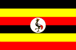
Uganda
UGANDA: 'One million to test' campaign logs first victory
UGANDA: Children quit school as aid dries up
UGANDA: Draft HIV bill's good intentions could backfire
UGANDA: Post-traumatic stress rife in the north
RWANDA-UGANDA: Cross-continent truckers risk more than HIV
UGANDA: Displaced first by war, now by elephants
Official Name: Republic of Uganda
Geography
Capital: Kampala
Major Towns: Kampala, Masaka, Mbarara, Mbale, Moroto, Gulu
Location (geographical coordinates/latitude and longitude): Kampala: 0°19'N, 32°35'E
Time Zone: EAT
Size (Land and Sea): 236,040 km² (81st); Water: 15.39%
Borders with Kenya, Sudan, Democratic Republic of Congo, Rwanda, Tanzania
Elevation extremes: Lowest point: Lake Albert 621 m, highest point: Margherita (Mount Stanley) 5,110 m
Politics
Head of State: Yoweri Museveni (1986); Prime Minister: Apolo Nsibambi (1999)
Form of Government: Democratic Republic
Independancy (from the UK): October 9, 1962
Currency: Ugandan Shilling
Industry
Main Industries: sugar, brewing, tobacco, cotton textiles; cement, steel production.
Natural resources: copper, cobalt, hydropower, limestone, salt, arable land
Agriculture: coffee, tea, cotton, tobacco, cassava (tapioca), potatoes, corn, millet, pulses, cut flowers; beef, goat meat, milk, poultry
Population and People
Population: 30,262,610 (2007 est.); 27,616,0001 (2005)
Population density per sq mi: 392
Growth rate: 3.6% (2007 est.)
Birth Rate: 48.1births/1,000 population (2007 est.)
Total fertility rate: 6.84 children born/woman (2007 est.)
Infant mortality rate: 67.2/1000
Religion: Christianity: 85.1%; Islam: 12.1%; Traditional Religions: 1%; 'Other Non-Christians: 0.7%
Languages: English, Swahili, Luganda, Ateso
Ethnic groups / Tribes: Mainly: Bantu, Nilotic, and Central-Sudanic. Many different ethnic groups, none of whom form a majority of the population
Age structure: 0-14 years: 50.2% (male 7,646,619/female 7,538,137); 15-64 years: 47.6% (male 7,231,196/female 7,185,058); 65 years and over: 2.2% (male 281,317/female 380,283) (2007 est.)
Life expectancy: 51.8
Literacy: 69.90%
coming
 Text Area - Uganda
 Content List - Uganda News
 Map - Uganda Map