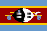
Swaziland
SWAZILAND: Women's equality in theory, but not in practice
SWAZILAND: ARV programme needs to double
SWAZILAND: Ignoring protests will not make them go away
SWAZILAND: Treatment programme woes
SWAZILAND: Voters hoping to make a difference
SWAZILAND: Bomb blast kills two
Offical Name: Kingdom of Swaziland
Geography
Capital: Lobamba (royal and legislative); Mbabane (administrative)
Major Towns: Mbabane, Manzini, Lobamba, Mankayane, Mhlume
Location (geographical coordinates/latitude and longitude): Mbabane: 26°19'S, 31°8'E
Time Zone UTC+2
Size (Land and Sea): 17,364 km²; 0.9% Water
Borders with South Africa and Mozambique
Elevation extremes: Lowest point : Great Usutu River 21 m, highest point: Emlembe 1,862 m
Politics
Head of State: King: Mswati III; Prime Minister: Themba Dlamini
Form of Government: Monarchy
Independancy (from UK): September 6, 1968
Currency: Lilangeni
Industry
Main industries: Sugar industry, Soft drink concentrate, wood pulp and lumber, agricultural exports (Pineapple, citrus fruit, and cotton), Mining (coal, diamonds, quarry, raw asbestos)
Natural resources: asbestos, coal, clay, cassiterite, hydropower, forests, small gold and diamond deposits, quarry stone, talc
Agriculture: sugarcane, cotton, corn, tobacco, rice, citrus, pineapples, sorghum, peanuts; cattle, goats, sheep
Population and People
Population: 1,133,066 (2007 est.); 1,032,000 (July 2005); 1,173,900 (2001)
Population density per sq mi: 171
Growth rate: 1.6% (2002 est.)
Birth rate: 27.0 births/1,000 population (2007 est.)
Total fertility rate: 3.43 children born/woman (2007 est.)
Infant mortality rate: 70.7/1000
Religion: Christianity: 82.70%; Islam: 0.95%, Bahai: 0.5%, Hinduism: 0.15%
Languages: English, Swazi, Zulu
Ethnic groups / Tribes: Majority Swazi; Zulus, non-Africans (British&Afrikaander)
Age structure: 0-14 years: 40.3% (male 230,238/female 226,184); 15-64 years: 56.1% (male 304,899/female 331,036); 65 years and over: 3.6% (male 15,870/female 24,839) (2007 est.)
Life expectancy: 32.2
Literacy: 78%
coming
 Text Area - Swaziland
 Content List - Swaziland News
 Map - Swaziland Map