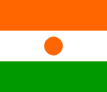
Niger
Areva wins Niger uranium licence
Niger: 2 Canadian Diplomats Missing
Niger ALERT: Two Journalists in prison for defamation
NIGER UPDATE : Journalist refused bail
Niger ALERT: Newspaper editor in detention for defamation
French section of MSF forced to leave Niger
National name: République du Niger
Geography
Capital: Niamey
Major Towns: Niamey, Agadez, Tahoua, Diffa, Zinder, Maradi
Location (geographical coordinates/latitude and longitude): Niamey: 13°32'N, 2°05'E
Time Zone: WAT (UTC+1)
Size (Land and Sea): 1,267,000 km²; Water: 0.02%
Borders with Nigeria, Benin, Burkina Faso, Mali, Algeria, Libya, Chad
Elevation extremes: Lowest point is the Niger River, 200 metres (722 ft), highest point is Monts Bagzane at 2,022 metres (6,634 ft)
Politics
Head of State: President: Tandja Mamadou, Prime Minister: Seyni Oumarou
Form of Government: Parliamentary Democracy
Independancy (from France): August 3, 1960
Currency: CFA Franc
Industry
Industries: uranium mining, cement, brick, soap, textiles, food processing, chemicals, slaughterhouses.
Natural resources: uranium, coal, iron ore, tin, phosphates, gold, petroleum
Agriculture: cowpeas, cotton, peanuts, millet, sorghum, cassava (tapioca), rice; cattle, sheep, goats, camels, donkeys, horses, poultry
(The poorest country in the world, ranking last on the United Nations Development Programme's Human Development Index)
Population and People
Population: 12,894,865 (2007 est.); 13,957,000 (July 2005 est.)
Population density per sq mi: 26
Growth rate: 2.9% (2007 est.)
Birth rate: 50.2/1000
Total fertility rate: 7.37 children born/woman (2007 est.)
Infant mortality rate: 116.8/1000
Religion: Islam: 80%, Animism: 15%, Christianity: 5%, growing number of Jehovah's Witnesses
Languages: French, Hausa, Zarma&Songhai, Tamajeq, Fulfulde, Kanuri,
Ethnic groups / Tribes: largest ethnic groups are the Hausa, the Djerma-Songhai, the Anasara, the Chinois, from the far east. The remainder are nomadic or semi-nomadic livestock-raising peoples—Fulani, Tuareg, Kanuri, Arabs, and Toubou
Age structure: 0-14 years: 46.9% (male 3,083,871/female 2,969,201); 15-64 years: 50.6% (male 3,354,783/female 3,174,039); 65 years and over: 2.4% (male 155,430/female 157,541) (2007 est.)
Life expectancy: 44.0
Literacy: 28% (2004 est.)
coming
 Text Area - Niger
 Content List - Niger News


 Map - Niger Map