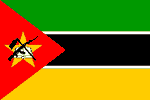
Mozambique
Mozambique: Cheap rail travel boosts cross-border trade
MOZAMBIQUE: The goal is clean water for all
MOZAMBIQUE: Buried treasure, hidden risks
MOZAMBIQUE-ZIMBABWE: The commodities lifeline
MOZAMBIQUE: Winning small victories against HIV and TB
MOZAMBIQUE: Love, or the next best thing, for sale
National name: República de Moçambique
Geography
Capital: Maputo
Major Towns: Maputo, Mutare, Inhambane, Beira, Pemba
Location (geographical coordinates/latitude and longitude): Maputo: 25°57'S, 32°35'E
Time Zone: CAT (UTC+2)
Size (Land and Sea): 801,590 km², Water: 2.2%
Borders with Indian Ocean, Tanzania, Malawi, Zambia, Zimbabwe, Swaziland and South Africa
Elevation extremes: Lowest point: Indian Ocean 0 m, highest point: Monte Binga 2,436 m
Politics
Head of State: President: Armando Guebuza, Prime Minister: Luísa Diogo
Form of Government: Republic
Independancy (from Portugal): June 25, 1975
Currency: Mozambican Metical
Industry
Industries: food, beverages, chemicals (fertilizer, soap, paints), aluminum, petroleum products, textiles, cement, glass, asbestos, tobacco.
Natural resources: coal, titanium, natural gas, hydropower, tantalum, graphite
Agriculture: cotton, cashew nuts, sugarcane, tea, cassava (tapioca), corn, coconuts, sisal, citrus and tropical fruits, potatoes, sunflowers; beef, poultry
Population and People
Population: 20,905,585 (2007 est.); 19792000 (July 2005 est.), 16,099,246 (1997)
Population density per sq mi: 69
Growth rate: 1.8% (20027 est.)
Birth rate: 38.5 births/1,000 population (2007 est.)
Total fertility rate: 5.29 children born/woman (2007 est.)
Infant mortality rate: 109.9/1000
Religion: Indigenous beliefs 50%, Christian 30%, Muslim 20%
Languages: Portuguese, Zulu, Makonde, Tsonga,
Ethnic groups / Tribes: Indigenous tribal groups 99.66% (Shangaan, Chokwe, Manyika, Sena, Makua, and others), Europeans 0.06%, Euro-Africans 0.2%, Indians 0.08%
Age structure: 0-14 years: 44.7% (male 4,692,126/female 4,647,960); 15-64 years: 52.5% (male 5,345,618/female 5,633,511) ; 65 years and over: 2.8% (male 244,886/female 341,484) (2007 est.)
Life expectancy: 40.9
Literacy: Total population: 42.3%, male: 58.4%, female: 27% (1998 est.)
coming
 Text Area - Mozambique
 Content List - Mozambique News
 Map - Mozambique Map