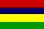
Mauritius
MAURITIUS: No longer forbidden love
MAURITIUS: No longer forbidden love
SOUTHERN AFRICA: Zimbabwe not on summit agenda
MAURITIUS: Dangerous paradise - sex, drugs and HIV
Official Name: Republic of Mauritius
Geography
Capital: Port Louis
Major Towns: Port Louis, Goodlands, Centre de Flacq, Tamarin,
Location (geographical coordinates/latitude and longitude): Port Louis: 20°10'S, 57°31'E
Time Zone: MUT (UTC+4)
Size (Land and Sea): 2,040 km², Water: 0.05%
Borders with: Mauritius is an island nation off the coast of Africa in the southwest Indian Ocean, about 900 kilometers east of Madagascar; includes the islands of St. Brandon, Rodrigues and the Agalega Islands. Mauritius is part of the Mascarene Islands, with Réunion 200 km to the southwest and the island of Rodrigues 570 km to the East-northeast.
Elevation extremes: Lowest point: Indian Ocean 0 m, highest point : Piton de la Petite Riviere Noire 828 m
Politics
Head of State: President: Anerood Jugnauth, Prime Minister: Navinchandra Ramgoolam
Form of Government: Republic
Independancy (from UK): March 12, 1968; Republic: March 12, 1992
Currency: Mauritian Rupee
Industry
Main Industries: food processing (largely sugar milling), textiles, clothing, chemicals, metal products, transport equipment, nonelectrical machinery, tourism.
Natural resources: arable land, fish
Agriculture: sugarcane, tea, corn, potatoes, bananas, pulses; cattle, goats; fish
Population and People
Population: 1,250,882 (2007 est.); 1219220 (2006 est.)
Population density per sq mi: 1,752
Growth rate: 0.8% (2007 est.)
Birth rate: 15.3 births/1,000 population (2007 est.)
Total fertility rate: 1.94 children born/woman (2007 est.)
Infant mortality rate: 14.1/1000
Religion: Hindu 52%, Christian 28.3% (Roman Catholic 26%, Protestant 2.3%), Muslim 16.6%, other 3.1%
Languages: English
Ethnic groups / Tribes: Indo-Mauritian 68%, Creole 27%, Sino-Mauritian 3%, Franco-Mauritian 2%
Age structure: 0-14 years: 23.5% (male 147,808/female 146,270); 15-64 years: 69.8% (male 436,043/female 437,441) ; 65 years and over: 6.7% (male 32,475/female 50,845) (2007 est.)
Life expectancy: 72.9
Literacy: 82%
coming
 Text Area - Mauritius
 Content List - Mauritius News


 Map - Mauritius Map