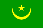
Mauritania
Mauritania ALERT: Two journalists detained briefly
Mauritania cuts ties with Israel, expels Israeli diplomats
Mauritania UPDATE: Court grants bail to detained ex-minister
Mauritania Forum Proposes May 30 Election
MAURITANIA: Desertification threatens to wipe out livelihoods, communities
MAURITANIA: Military launches anti-terrorist units amid donor cutbacks
Official Name: Islamic Republic of Mauritania
National name: Al Jumhuriyah al Islamiyah al Muritaniyah
Geography
Capital: Nouakchott
Major Towns: Nouakchott, Nouadhibou, Rosso, Atar, F'derik
Location (geographical coordinates/latitude and longitude): Nouakchott: 18°09'N, 15°58'W
Time Zone: GMT
Size (Land and Sea): 1,030,700 km², Water: 0.03%
Borders with Atlantic Ocean, Senegal, Mali, Algeria, Western Sahara
Elevation extremes: Lowest point: Sebkha de Ndrhamcha -3 m, highest point: Kediet Ijill 910 m
Politics
Head of State: President: Sidi Ould Cheikh Abdallahi, Prime Minister: Zeine Ould Zeidane
Form of Government: Parliamentary Democracy
Independancy (from France): November 28, 1960
Currency: Ouguiya
Industry
Industries: fish processing, mining of iron ore and gypsum.
Natural resources: iron ore, gypsum, copper, phosphate, diamonds, gold, oil, fish
Agriculture: dates, millet, sorghum, rice, corn; cattle, sheep
Population and People
Population: 3,270,065 (2007 est.); 3,069,000 (2005 est.), 1,864,236 (1988)
Population density per sq mi: 8
Growth rate: 2.92% (2007 est.)
Birth rate: 40.54 births/1,000 population (2002 est.)
Total fertility rate: 5.78 children born/woman (2007 est.)
Infant mortality rate: 68.1/1000
Religion: 99.84% Muslim, most of whom are Sunnis.
Languages: Arabic, French
Ethnic groups / Tribes: 40% mixed Arab/black; 30% Arab; 30% Black
Age structure: 0-14 years: 45.5% (male 744,995/female 741,369); 15-64 years: 52.4% (male 845,272/female 866,998); 65 years and over: 2.2% (male 28,564/female 42,867) (2007 est.)
Life expectancy: 53.5
Literacy: Total population: 41.2%, male: 51.5%, female: 31.3% (2002 est.)
coming...
 Text Area - Mauritania
 Content List - Mauritania News


 Map - Mauritania Map