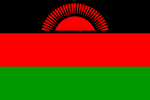
Malawi
Cholera outbreak kills 11 in Malawi
MALAWI: Malawi: Adamson Muula, "Are educational standards going down?"
MALAWI: Solving health worker shortages
MALAWI: Jackson Edward: "I may live longer than the people who talk ill about me"
MALAWI: Green belts to boost food production
MALAWI: AIDS organisations face funding interruptions
Republic of Malawi
Geography
Capital: Lilongwe
Major Towns: Blantyre, Lilongwe, Chipoka, Nhkotakota, Mzuzu
Location (geographical coordinates/latitude and longitude): Lilongwe: 13°57'S, 33°42'E
Time Zone: CAT (UTC+2)
Size (Land and Sea): 118,484 km², Water: 20.6%
Borders with Zambia, Tanzania, and Mozambique
Elevation extremes: Lowest point: junction of the Shire River and international boundary with Mozambique 37 m, highest point: Mount Mlanje Sapitwa 3,002 m
Politics
Head of State: President: Bingu wa Mutharika
Form of Government: Multi-party democracy
Independancy declared from UK: July 6, 1964 , Republic: July 6, 1966
Currency: Kwacha
Industry
Main Industries: tobacco, tea, sugar, sawmill products, cement, consumer goods.
Natural resources: limestone, arable land, hydropower, unexploited deposits of uranium, coal, and bauxite.
Agriculture: tobacco, sugarcane, cotton, tea, corn, potatoes, cassava (tapioca), sorghum, pulses, groundnuts, Macadamia nuts; cattle, goats
Population and People
Population: 13,603,181 (2007 est.); 12,884,000 (2005 est.), 9,933,868 (1998)
Population density per sq mi: 374
Growth rate: 2.4% (2007 est.)
Birth rate: 42.1 births/1,000 population (2007 est.)
Total fertility rate: 5.74 children born/woman (2007 est.)
Infant mortality rate: 92.1/1000
Religion: Protestant 55%, Roman Catholic 20%, Muslim 20%, traditional indigenous beliefs
Languages: English, Chichewa, Lomwe, Nyanja, Tumbuka
Ethnic groups / Tribes: Chewa, Nyanja, Tumbuko, Yao, Lomwe, Sena, Tonga, Ngoni, Ngonde, Asian, European
Age structure: 0-14 years: 46.1% (male 3,143,724/female 3,130,937); 15-64 years: 51.2% (male 3,491,114/female 3,474,209); 65 years and over: 2.7% (male 155,954/female 207,243) (2007 est.)
Life expectancy: 43.0
Literacy: Total population: 58%, male: 72.8%, female: 43.3% (1999 est.)
coming
 Text Area - Malawi
 Content List - Malawi News
 Map - Malawi Map