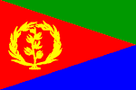
Eritrea
ERITREA: Food shortages feared as rains fail
ERITREA: Use harvest wisely, government urges
ERITREA: US report decries human rights violations
Eritrea / Ethiopia: 378 persons repatriated
ERITREA: Interview - President says border issues "must be resolved"
National name: Hagere Ertra
Geography
Capital: Asmara
Major Towns: Gînda, Massawa, Assab
Location (geographical coordinates/latitude and longitude): 15°20'N, 38°55'E
Time Zone: EAT (UTC+3)
Size (Land and Sea): 121,320 sq km
Borders with Djibouti 109 km, Ethiopia 912 km, Sudan 605 km
Elevation extremes: Lowest point: near Kulul within the Denakil depression -75 m; Highest point: Soira 3,018m
Politics
Head of State: President Isaias Afewerki
Form of Government: Transitional government
Independancy (from Ethiopia): May 24 1993
Currency: Nakfa (ERN)
Industry
Agriculture: sorghum, lentils, vegetables, corn, cotton, tobacco, coffee, sisal; livestock, goats; fish.
Industries: food processing, beverages, clothing and textiles, salt, cement, commercial ship repair.
Natural resources: gold, potash, zinc, copper, salt, possibly oil and natural gas, fish.
Population and People
Population: 4,906,585 (July 2007 est.)
Population density per sq mi: 105
Growth rate: 2.5%
Birth rate: 33.97 births/1,000 population (2007 est.)
Total fertility rate: 4.96 children born/woman (2007 est.)
Infant mortality rate: 45.2/1000
Religion: Muslim, Coptic Christian, Roman Catholic, Protestant
Languages: Afar, Arabic, Tigre and Kunama, Tigrinya, other Cushitic languages
Ethnic groups / Tribes: Tigrinya 50%, Tigre and Kunama 40%, Afar 4%, Saho (Red Sea coast dwellers) 3%, other 3%
Average age: 0-14 years: 43.5% (male 1,073,404/female 1,060,674); 15-64 years: 52.9% (male 1,286,613/female 1,310,294); 65 years and over: 3.6% (male 85,052/female 90,548) (2007 est.)
Life expectancy: 59.6
Literacy (definition: age 15 and over can read and write): Total population: 58.6%; male: 69.9%; female: 47.6% (2003 est.)
- The name Eritrea is the Italian form of the Greek name Erythraîa which derives from the Greek term for the Red Sea `Erithrá thálassa
- Some of the earliest remains in the world of humans using tools to harvest marine resources were found at a site near the bay of Zula south of Massawa, with some tools dated to over 125,000 years old
- Located in the Horn of Africa
- Dahlak Archipelago consists of more than 200 islands with flat reef gardens and a variety of fish
- In 2006, Eritrea announced it would become the first country in the world to turn its entire coast into an environmentally protected zone. The 1,347 km (837 mile) coastline, along with another 1,946 km (1,209-miles) of coast around its more than 350 islands, will come under governmental protection. (Wikipedia)
- Hanish Islands
- Interesting buildings and sites from the Turkish and Egyptian colonial periods
- No official language, but three working languages: Tigrinya, Arabic and English
- Cuisine reflects the period of Italian rule
- High central plateau that varies from 1,800 to 3,000 meters
- Eritrea was merged into Ethiopia in a federal arrangement brokered by the UN in 1952 and incorporated fully into Ethiopia 10 years later
- Vast array of wildlife: Native to the country are elephants, lions, baboons, gazelles, leopards, ostriches and turtles. Many species of fish, including angelfish, barracudas, butterfly fish and several varieties of crabs, sea cucumbers and jellyfish
- Eritrea formerly supported a large population of elephants. Ptolemaic kings of Egypt used it as a source of war elephants in the third century BC. Between 1955 and 2001 there were no reported sightings of elephant herds, and they were thought to have fallen victim to the war of independence. In December 2001 a herd of about 30, including 10 juveniles, was observed in the vicinity of the Gash River. The elephants seemed to have formed a symbiotic relationship with olive baboons. It is estimated that there are around 100 elephants left in Eritrea, the most northerly of East Africa's elephants (Wikipedia)
- Dankalia: volcanic desert, lunar landscapes. one of the hottest and most inhospitable places on Earth
- Massawa Island with an astounding blend of Egyptian, Turkish and Italo-Moorish architecture
- Capital Asmara with Italian architecture, the main cathedral (built in 1922), bustling markets, Asmara Theatre (built in 1918) and National Avenue as the main meeting point in town with numerous cafes, restaurants and bars.
- Massawa has the largest natural deep-water port on the Red Sea. Turko-Egyptian architecture. The city is made up of three parts: two islands (Batse and Tualud) and the mainland part of Massawa. Take a boat trip to Sheikh Said Island (also known as Isola Verde), a favourite picnic spot
- Emberemi is famous for the mausoleums of Sheikh el Amin and Muhammad Ibn Ali and an important pilgrimage site
- Religious sites of the Tomb of Said Abu Bakr el Mirgani and the Mariam de Arit. Debre Sina, near Elabered on the Asmara–Keren road
- Wide sandy beaches and calm seas along the Red Sea coast
- Merging of the Italian colonial influence with the traditional Tigrinya lifestyle
 Text Area - Eritrea
 Content List - Eritrea News


 Map - Eritrea Map