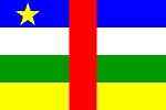
Central African Republic
In Brief: Grim outlook for Central African Republic's children
CENTRAL AFRICAN REPUBLIC: Living in fear after rebel attack
CENTRAL AFRICAN REPUBLIC: Mahamat Oumar Ismael, "Go back to Darfur? Not even in my dreams"
CENTRAL AFRICAN REPUBLIC: Who’s who with guns?
CENTRAL AFRICAN REPUBLIC: “We fear we will never see our husbands again”
Central African Republic: aid for 20,000 displaced people
National name: République Centrafricaine
Geography
Capital: Bangui
Major Towns: Nola, Bangassou, Bossangoa, Bambari
Location (geographical coordinates/latitude and longitude): 7 00 N, 21 00 E
Time Zone: UTC+1
Size (Land and Sea): 622,984 sq km
Borders with Cameroon 797 km, Chad 1,197 km, Democratic Republic of the Congo 1,577 km, Republic of the Congo 467 km, Sudan 1,165 km
Elevation extremes: Lowest point: Oubangui River 335 m; highest point: Mont Ngaoui 1,420 m
Politics
Head of State: President: Gen. François Bozizé (2003); Prime Minister: Faustin Archange Touadéra (2008)
Form of Government: Republic
Independancy (from France): August 13, 1960
Currency: CFA franc (XAF)
Industry
Main Industries: gold and diamond mining, logging, brewing, textiles, footwear, assembly of bicycles and motorcycles.
Natural resources: diamonds, uranium, timber, gold, oil, hydropower.
Agriculture: cotton, coffee, tobacco, manioc (tapioca), yams, millet, corn, bananas; timber.
Population and People
Population: 4,369,038
Population density per sq mi: 18
Growth rate: 1.5%
Birth rate: 33.52 births/1,000 population (2007 est.)
Total fertility rate: 4.32 children born/woman (2007 est.)
Infant mortality rate: 84.0/1000
Religion: Indigenous beliefs 35%, Protestant 25%, Roman Catholic 25%, Muslim 15%
note: animistic beliefs and practices strongly influence the Christian majority
Languages: French (official), Sangho (lingua franca and national language), tribal languages
Ethnic groups / Tribes: Baya 33%, Banda 27%, Mandjia 13%, Sara 10%, Mboum 7%, M'Baka 4%, Yakoma 4%, other 2%
Average age: 0-14 years: 41.6% (male 914,566/female 903,849); 15-64 years: 54.2% (male 1,174,520/female 1,195,364); 65 years and over: 4.1% (male 71,355/female 109,384) (2007 est.)
Life expectancy: 43.7
Literacy (definition: age 15 and over can read and write): Total population: 51%; male: 63.3%; female: 39.9% (2003 est.)
- Equatorial forest zone in the south
- Two thirds of the country lie in the basins of the Ubangi river
- Congo River
- Lake Chad
- Bantu languages
- 5,203 km land boundaries
- Natural resources: diamonds, uranium, timber, gold, petroleum, hydropower
- Agricultural products like as cassava, peanuts, maize, sorghum, millet, sesame and plantains
- Total cassava production per year between 200,000 and 300,000 tons
- Between 25,000 and 40,000 tons of cotton
- Export of cotton, coffee, tobacco, timber
- Industries: diamond mining, sawmills, breweries, textiles, footwear, assembly of bicycles and motorcycles
- Good potential as ecotourist destinations: The country is noted for its population of forest elephants
- Rainforests
- Magnificent national parks, like Dzanga-Sangha National Park, Manovo-Gounda St Floris, Bamingui-Bangoran
- Wildlife, including leopards, lions, and rhinos
- More than 80 ethnic groups
- 51 airports, 3 with paved runways
- Forests
- Waterfalls
- Arts and craft
- The capital Bangui at the River Ubangi, with Central Market, Museums, Arts and Craft School and the Hausa Quarter
- Indigenous forest tribes
- Coffee plantations
- Traditional architecture: huts made of lianas and roofed with leaves
- Boali Waterfalls
- Ancient burial mounds
- Kembe Falls on the River Kotto
- View gorillas in Bayanga
- Basketball
-
Wooden houses in the town of Zinga on the Oubangui river
 Text Area - Central African Republic
 Content List - Central African Republic News
 Map - CAR Map