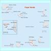
Cape Verde
CAPE VERDE: Urban crime, violence multiplies
CAPE VERDE: Deported youth offenders face drugs, unemployment
CAPE VERDE: Money laundering taints economic growth
CAPE VERDE: Clandestine housing squeezes cities
CAPE VERDE: Clandestine housing squeezes cities
CAPE VERDE: Money laundering taints economic growth
National name: República de Cabo Verde
Geography
Capital: Praia
Major Towns: Mindelo, Santa Maria, Tarrafal
Location (geographical coordinates/latitude and longitude): 14°55'N, 23°31'W
Time Zone: CVT (UTC-1)
Size (Land and Sea): 4,033 sq km
Borders with Atlantic Ocean
Elevation extremes: Lowest point: Atlantic Ocean 0 m; highest point: Mt. Fogo 2,829 m (a volcano on Fogo Island)
Politics
Head of State: President: Pedro Pires (2001), Prime Minister: José Maria Neves (2001)
Form of Government: Republic
Independancy (from Portugal): July 5, 1975.
Currency: Cape Verdean escudo (CVE)
Industry
Main Industries: food and beverages, fish processing, shoes and garments, salt mining, ship repair.
Natural resources: salt, basalt rock, limestone, kaolin, fish, clay, gypsum.
Agriculture: bananas, corn, beans, sweet potatoes, sugarcane, coffee, peanuts; fish.
Population and People
Population: 423,613 (July 2007 est.)
Population density per sq mi: 271
Growth rate: 0.6%
Birth rate: 24.4 births/1,000 population (2007 est.)
Total fertility rate: 3.28 children born/woman (2007 est.)
Infant mortality rate: 45.3/1000
Religion: Roman Catholic (infused with indigenous beliefs), Protestant (mostly Church of the Nazarene)
Languages: Portuguese, Crioulo (a blend of Portuguese and West African words)
Ethnic groups / Tribes: Creole (mulatto) 71%, African 28%, European 1%
Average age: 0-14 years: 36.9% (male 78,971/female 77,524); 15-64 years: 56.4% (male 116,751/female 122,065); 65 years and over: 6.7% (male 10,423/female 17,879) (2007 est.)
Life expectancy: 71.0
Literacy (definition: age 15 and over can read and write): Total population: 76.6%; male: 85.8%; female: 69.2% (2003 est.)
- located on an archipelago in the Macaronesia ecoregion
- the country is named after Cap Vert (meaning Green Cape) in Senegal, the westernmost point of continental Africa
- Cape Verde was uninhabited when the Portuguese arrived in 1460
- 620 kilometers (385 mi.) off the west coast of Africa
- Highest point: Mount Fogo 2,829 m (a volcano on Fogo Island)
- Natural resources :Salt, basalt rock, pozzuolana (a siliceous volcanic ash used to produce hydraulic cement), limestone, kaolin, fish
- large number of endemic species
- Endemic birds include Alexander's Swift (Apus alexandri), Raso Lark (Alauda razae), Cape Verde Warbler (Acrocephalus brevipennis), and Iago Sparrow (Passer iagoensis), and reptiles include the Cape Verde Giant Gecko (Tarentola gigas)
- the months April to July record less than one millimetre of rainfall each
- lobster and tuna fishing
- famous for morna, a form of folk music usually sung in the Cape Verdean Creole, accompanied by clarinet, violin, guitar and cavaquinho
- mixed African and Portuguese roots
- Cape Verde comprises 10 volcanic islands
- Africa’s most westerly point
- spectacular mountain scenery
- beautiful deserted beaches
- diving paradise
- São Vicente’s is renowned for its exuberant Carnival
- Portuguese foods (such as fish- and seafood-based dishes, olive oil, garlic, lemon and sausage) and African foods (stews, beans, maize and tropical crops) comfortably combined on most menus
- Portuguese architecture
- vibrant Creole culture
- watersports, such as windsurfing, diving (with shipwrecks dating back to the 16th century) and sailing
- mountain peaks
- salt pits of Sal
- live music on São Vicente
-
Ribeira Grande Mountain
 Text Area - Cape Verde
 Content List - Cape Verde News

 Map - Cape Verde Map