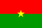
Burkina Faso
BURKINA FASO: Child brides fight child marriage
BURKINA FASO: Fistula in Sahel region highlighted
BURKINA FASO: Six killed and thousands affected by heavy rains
BURKINA FASO: European Union pledges more aid to fight malnutrition
BURKINA FASO: Finding new ways to feed HIV-positive people
WEST AFRICA: Cross-border FGM on the rise
Geography
Capital: Ouagadougou
Major Towns: Ouagadougou, Bobo-Dioulasso, Banfora, Ouahigouya, Kaya, Fada-Ngourma
Location (geographical coordinates/latitude and longitude): 12°20'N, 1°40'W
Time Zone: GMT
Size (Land and Sea): 274,200 sq km
Borders with Benin 306 km, Cote d'Ivoire 584 km, Ghana 549 km, Mali 1,000 km, Niger 628 km, Togo 126 km
Elevation extremes: Lowest point: Mouhoun (Black Volta) River 200 m; highest point: Tena Kourou 749 m
Politics
Head of State: President: Blaise Compaoré (1987); Prime Minister: Tertius Zongo (2007)
Form of Government: Parliamentary Republic
Independancy (from France): August 5, 1960
Currency: West African CFA franc (XOF)
Industry
Main industries: Cotton lint, beverages, agricultural processing, soap, cigarettes, textiles, gold
Agriculture: cotton, peanuts, shea nuts, sesame, sorghum, millet, corn, rice; livestock. Industries: cotton lint, beverages, agricultural processing, soap, cigarettes, textiles, gold.
Natural resources: manganese, limestone, marble; small deposits of gold, phosphates, pumice, salt.
Population and People
Population: 14,326,203 (2007 est.)
Population density per sq mi: 136
Growth rate: 3.0%
Birth rate: 45.28 births/1,000 population (2007 est.)
Total fertility rate: 6.41 children born/woman (2007 est.)
Infant mortality rate: 89.8/1000
Religion: Muslim 50%, indigenous beliefs 40%, Christian (mainly Roman Catholic) 10%
Languages: French (official), native African languages belonging to Sudanic family spoken by 90% of the population
Ethnic groups / Tribes: Mossi over 40%, other approximately 60% (includes Gurunsi, Senufo, Lobi, Bobo, Mande, and Fulani)
Average age: 0-14 years: 46.7% (male 3,356,737/female 3,327,058); 15-64 years: 50.9% (male 3,635,152/female 3,650,303); 65 years and over: 2.5% (male 141,554/female 215,399) (2007 est.)
Life expectancy: 49.2
Literacy (definition: age 15 and over can read and write): Total population: 21.8%; male: 29.4%, female: 15.2% (2003 est.)
- Sahara
- Tuaregs
- Camel ride
- mud buildings
- colourful weekly farmers markets
- Formerly called the Republic of Upper Volta
- famous and international annual film festival in Ouagadougou
- landlocked Sahel country
- game reserves (including Arly, Nazinga, and W National Park) with lions, elephants, hippopotamus, monkeys, warthogs, and antelopes
- natural resources include manganese, limestone, marble, phosphates, pumice, salt and small deposits of gold
- Popular Theatre in Ouagadougou
- major hub of activity for those involved in African cinema, and hosts a Pan-African film festival every year called FESPACO, the Pan-African film and television Festival of Ouagadougou
- Culture and art are further displayed at Laongo, an area of exposed granites where artists from the entire world are invited to sculpt on the rock
- some 60 different ethnic groups
- The Semaine Nationale de la Culture, held every two years since 1983, is a music festival that has helped produce the country's few stars
- famous Farafina musical group
- djembes, balafons and koras
- most advanced production and distribution facilities in West Africa, if not Africa as a whole
- nomadic populations and traditions
- Ethnography Museum with collection of Mossi artefacts
- Moro-Naba ceremony, with traditional costumes and drums, which takes place outside the Moro-Naba Palace every Friday morning
- International Arts and Crafts Fair in Ouagadougou
- Grand Marché, of Bobo Dioulasso
- Karfiguéla Waterfalls
-
Sindou Rock Formations
 Text Area - Burkina Faso
 Content List - Burkina Faso News

 Map - Burkina Faso Map