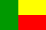
Benin
BENIN: Sorcery-linked infanticides persist in north
BENIN: Cotonou’s overlooked killer: air pollution
BENIN: Erosion-inducing coastal sand mining to be outlawed
BENIN: Blood shortage proves deadly
BENIN: Widespread smuggled gasoline costs economy, lives
BENIN: Screening out morally unfit crime fighters
National name: Republique du Benin
Geography
Capital: Porto-Novo
Major Towns: Cotonou, Parakou, Djougou
Location (geographical coordinates/latitude and longitude): 6°28'N, 2°36'E
Time Zone: WAT (UTC+1)
Size:112,620 sq km
Borders with: Burkina Faso 306 km, Niger 266 km, Nigeria 773 km, Togo 644 km
Elevation extremes: Lowest point: Atlantic Ocean 0 m
highest point: Mont Sokbaro 658 m"
Politics
Head of State: President Yayi Boni
Form of Government: Multiparty democracy
Independancy (from France): 01 August 1960
Currency: CFA franc (XOF)
Industry
Main industries (income): Textiles, food processing, construction materials, cement
Agriculture: cotton, corn, cassava (tapioca), yams, beans, palm oil, peanuts; livestock.
Industries: textiles, food processing, construction materials, cement. Natural resources: small offshore oil deposits, limestone, marble, timber
Population and People
Population: 8,078,314
Population density per sq mi: 189
Growth rate: 2.7%
Birth rate: 38.1 births/1,000 population (2007 est.)
Total fertility rate: 5.08 children born/woman (2007 est.)
Infant mortality rate: 77.9/1000
Religion: Christian 42.8% (Catholic 27.1%, Celestial 5%, Methodist 3.2%, other Protestant 2.2%, other 5.3%), Muslim 24.4%, Vodoun 17.3%, other 15.5% (2002 census)
Languages: French (official), Fon and Yoruba (most common vernaculars in south), tribal languages (at least six major ones in north)
Ethnic groups / Tribes: Fon and related 39.2%, Adja and related 15.2%, Yoruba and related 12.3%, Bariba and related 9.2%, Peulh and related 7%, Ottamari and related 6.1%, Yoa-Lokpa and related 4%, Dendi and related 2.5%, other 1.6% (includes Europeans), unspecified 2.9% (2002 census)
Average age: 0-14 years: 43.9% (male 1,788,248/female 1,754,940); 15-64 years: 53.7% (male 2,138,649/female 2,203,291); 65 years and over: 2.4% (male 77,844/female 115,342) (2007 est.)
Life expectancy: 53.4
Literacy (definition: age 15 and over can read and write): Total population: 34.7% ; male: 47.9% , female: 23.3% (2002 census)
- formerly known as Dahomey (until 1975)
- The largest city and commercial capital is Cotonou
- The name Cotonou is from the Fon phrase ku t? nu 'at the lake of the dead', from the adjacent lagoon. This is a reference to the belief that falling stars represent the souls of those who have just died falling to the underworld. It is said that when Cotonou was founded, the lights of the lacustrine village of Ganvié across the lagoon were reflected in the waters, suggesting fallen stars at the bottom. Ganvié is a fishing village sitting in the water on stilts at the western shore of the lagoon
- Cotton production
- Lies between the Equator and the Tropic of Cancer
- Limestone, marble, timber
- Voodoo: Indigenous religions are followed by a majority of the people: local animistic religions in the Atakora (Atakora and Donga provinces) and Vodun among the Yoruba and Tado peoples in the center and south of the country. The town of Ouidah on the central coast is the spiritual center of Beninese vodun.
- One of the biggest music stars to come out of the continent: Angélique Kidjo
- Academy Award-nominated Beninese actor: Actor Djimon Gaston Hounsou
- Fetish markets and temples and voodoo culture
- Slave trade history remains
- Architectural anomalies such as stilt villages and mud fortresses
- Port Novo with museums, cultural activities and night entertainment
- Ganvie: houses builts on stilts and water-market
- Wildlife, including cheetahs, hippos and crocodiles
- Beautiful beaches
- Nakoue Lagoon
 Text Area - Benin
 Content List - Benin News
 Map - Benin Map