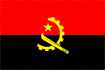
Angola
ANGOLA: Fun and games in the fight against AIDS
Ebola alert shuts Angolan border
ANGOLA: Government pledges to provide better health care
ANGOLA: Prevention made in China
Angola Bad Choice to Host World Habitat Day
ANGOLA: How free will the elections be?
National name: Republica de Angola
Geography
Capital: Luanda
Major Towns: Luanda, Huamba , Lubango
Location (geographical coordinates/latitude and longitude): 8°50'S, 13°20'E
Time Zone: WAT (UTC+1)
Size: 1,246,700 sq km
Borders with: Democratic Republic of the Congo (2,511 km), Republic of Congo (201 km), Namibia (1,376 km) and Zambia (1,110 km)
Elevation extremes (lowest and highest points): Lowest point: Atlantic Ocean 0 m;
Highest point: Morro de Moco 2,620 m
Politics
Head of State: President: José Eduardo dos Santos (1979); Prime Minister: Fernando da Piedade Dias dos Santos (2003)
Form of Government: Republic; multiparty presidential regime
Independancy (from Portugal): 11 November 1975
Currency: Kwanza (AOA)
Industry
Main industries: Petroleum; diamonds, iron ore, phosphates, feldspar, bauxite, uranium, and gold; cement; basic metal products; fish processing; food processing, brewing, tobacco products, sugar; textiles; ship repair.
Agriculture: Bananas, sugarcane, coffee, sisal, corn, cotton, maioc, tobacco
Population and People
Population: 12,263,596 (July 2007 est.)
Population density per sp mi: 25
Growth rate 2,2%
Birth rate: 44.51 births/1,000 population (2007 est.)
Total fertility rate: 6.27 children born/woman (2007 est.)
Infant Mortality Rate: 184.4/1000
Religion: Indigenous beliefs 47%, Roman Catholic 38%, Protestant 15% (1998 est.)
Languages: Portuguese (official), Bantu and other African languages
Ethnic groups / Tribes: Ovimbundu 37%, Kimbundu 25%, Bakongo 13%, mestico (mixed European and native African) 2%, European 1%, other 22%
Average age: 0-14 years: 43.7% (male 2,706,276/female 2,654,338); 15-64 years: 53.5% (male 3,339,114/female 3,225,121); 65 years and over: 2.8% (male 149,414/female 189,333) (2007 est.)
Life Expactancy: 37.6
Literacy (definition: age 15 and over can read and write): Total population: 67.4%; male; 82.9%; female: 54.2% (2001 est.)
- Khoisan heritage (first inhabitants)
- 5,198 km of Land boundaries
- over 100 distinct tribes and linguistic dialects
- 1,600 km of coastline
- Mount Morro de Moco with 2,620 m
- rich resources - notably gold, diamonds, extensive forests, Atlantic fisheries, arable land, and large oil deposits
- agricultural products: bananas, sugarcane, coffee, sisal, corn, cotton, manioc (tapioca), tobacco
- 2,952 km of railways
- Capoeira Angola: fight, dance, play, music and philosophy, all in one
- Palancas Negras, ("The Black Antelopes") is the national football team of Angola, 2006 first time participation in World Cup
- Humbi-Humbi art gallery in Luanda
- great variety of wild animals
- Basketball remains a firm favourite, with Angola having won the African Basketball title on several occasions, attending the Olympics twice
- Calandula Waterfalls
- Mussulo Island
- Varied and tasteful cuisine, with fish, cassava products and spicy stews
- Abundant and very good seafood - Angolan coast is a special place to eat fresh lobster right off the fisherman's boat
- National specialties: Palm oil beans and Calulu (dried fish or dried meat layered with fresh fish or fresh meat, onion, tomatoes, okra and sweet potato leaves)
 Text Area - Angola
 Content List - Angola News


 Map - Angola Map